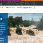
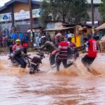
The DARAJA service and partnership, originally piloted through the Weather and Climate Information Services (WISER) Africa programme in Nairobi and Dar es Salaam during 2018-2020, reached 982,000 residents and achieved strong results in terms of enabling communities to take action in advance on the provision of early warnings.
Credit: Kounkuey Design Initiative (KDI)
Resurgence is leading DARAJA with its key partners, Kenya Meteorological Department (KMD) and Kounkuey Design Initiative (KDI), in Nairobi. From 2023-2025, supported by the WISER programme and Lloyds Register Foundation, DARAJA continued its service in Nairobi.


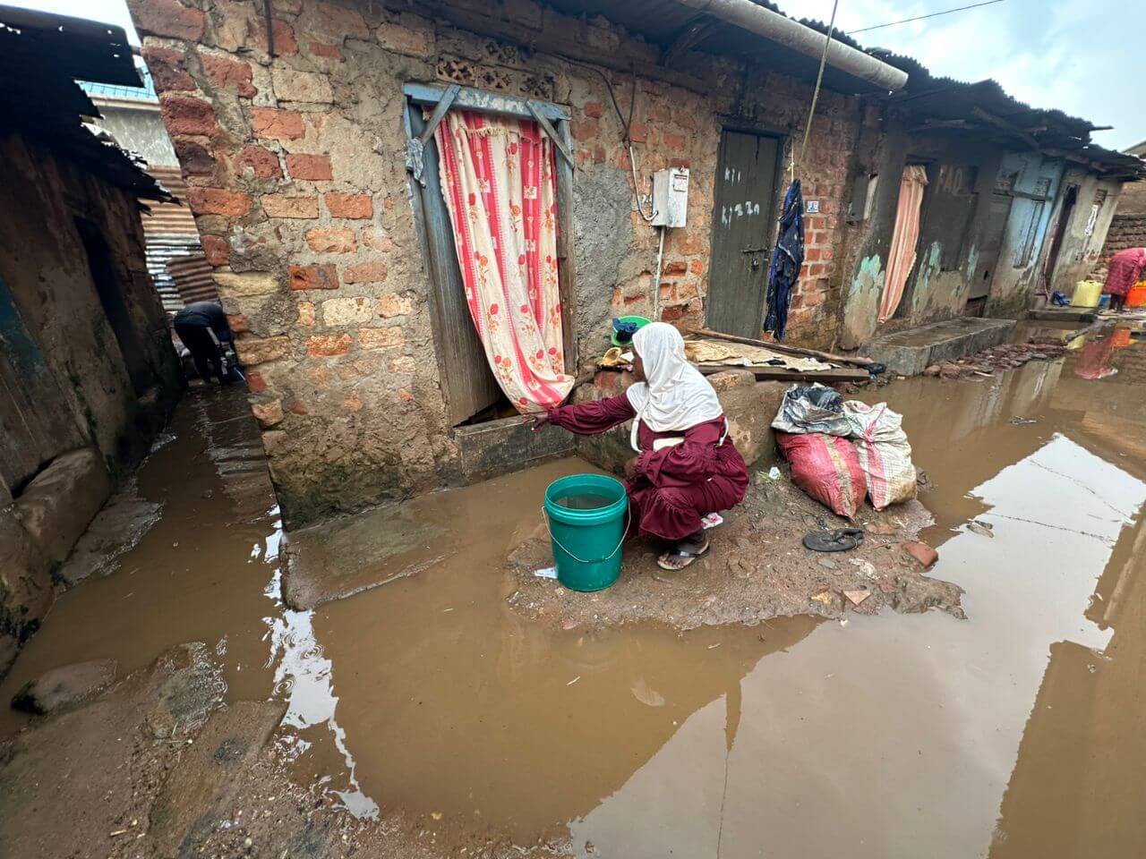


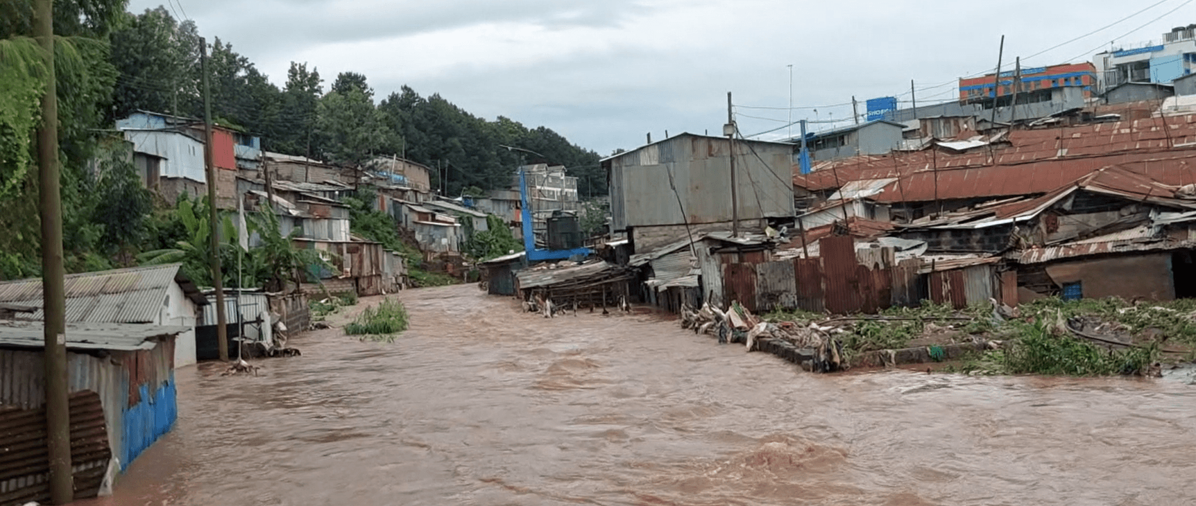
Following the success of DARAJA in Tanzania and Kenya during its first phase, the model has been replicated in Kampala, Uganda, and Addis Ababa, Ethiopia. Baseline research identified flooding, extreme heat, and strong winds as the primary climate hazards affecting residents of informal settlements in Kampala.
To enhance the resilience of these vulnerable communities, DARAJA is improving access to, understanding, and use of weather and climate information in Bwaise, Kampala. Since its launch in mid-2023, DARAJA has driven significant transformational change, including institutional strengthening, community engagement, stakeholder collaboration, broader access to weather and climate information, and scaling beyond Bwaise. These achievements highlight the value of the DARAJA model in strengthening the resilience within urban informal settlements—a vulnerable group that is frequently neglected in mainstream initiatives. The continued expansion of this model will not only benefit Uganda but also serve as an inspiration for other cities facing similar climate challenges.
From 2023-2025, supported by the WISER programme and Lloyds Register Foundation, DARAJA continued its service in Nairobi.
Our Impact in Nairobi
We use a combination of quantitative data and community insight to understand what is working and where systems can improve.
View Information Ecosystem Mapping
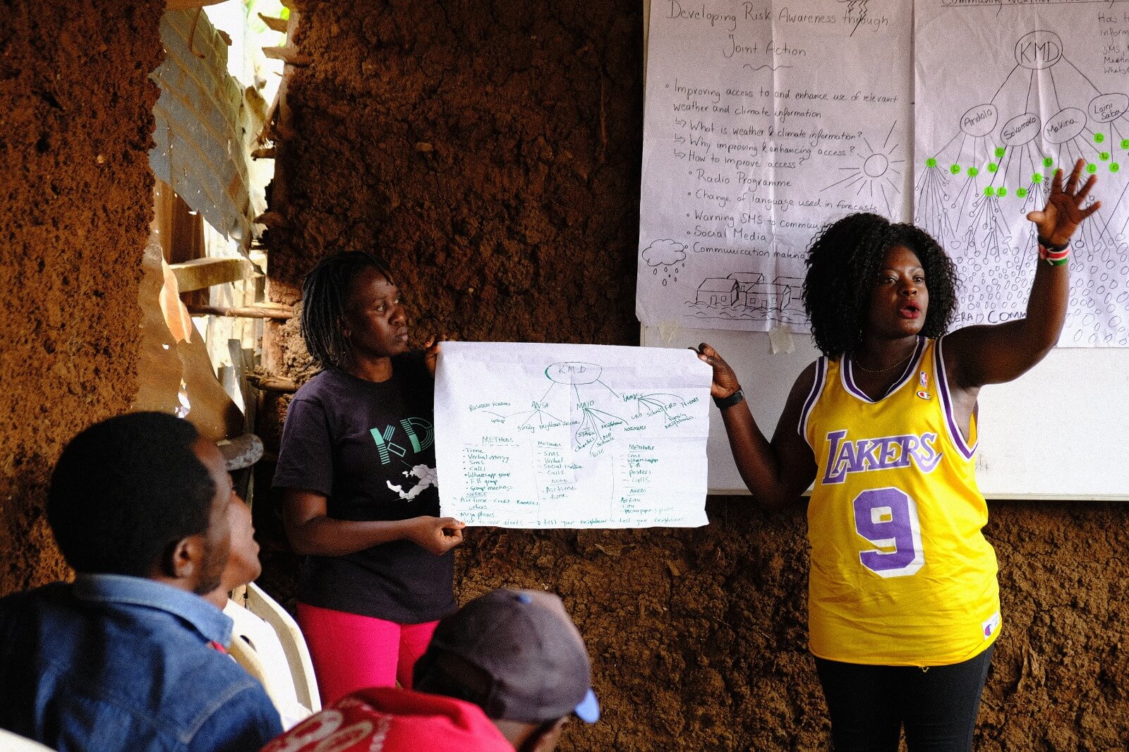
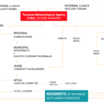
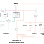
What is Information Ecosystem Mapping (IEM)?
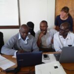
DARAJA Information Ecosystem Mapping (IEM) and feedback loops:DARAJA uses its proprietary Information Ecosystem Mapping to understand how climate information flows within communities and to continuously improve service delivery. IEM examines who produces and consumes information, what channels are trusted, and what barriers exist, ensuring climate services reach marginalised groups who often rely on informal or non-digital sources.Our IEM process involves:
- Mapping information flows: Identifying trusted intermediaries (e.g., community leaders, radio stations), preferred channels (e.g., WhatsApp, face-to-face communication), and communication bottlenecks
- Analysing trust networks: Understanding which sources communities trust and why
- Identifying gaps: Recognising who is excluded and what channels are underutilised
- Creating visual diagrams: Showing relationships between meteorological agencies, media outlets, community networks, and end-users
- Validating findings: With communities, adapting strategies over time that respects cultural and linguistic diversity
Updates
Latest articles, video, news, and thought leadership from this region.

How DARAJA turns Weather Warnings into Life-Saving Action
How DARAJA turns Weather Warnings into Life-Saving Action
DARAJA Early Action Plan Framework
DARAJA Early Action Plan Framework

DARAJA Stories of Change Nairobi
DARAJA Stories of Change Nairobi
DARAJA Nairobi & Dar es Salaam Impact Slide Deck (2020)
DARAJA Nairobi & Dar es Salaam Impact Slide Deck (2020)
2019 – Co-designing weather and climate information services for and with Urban Informal Settlements in Nairobi and Dar es Salaam
2019 – Co-designing weather and climate information services for and with Urban Informal Settlements in Nairobi and Dar es Salaam
April 2021- Meteo Tech Int article
April 2021- Meteo Tech Int article
Enhancing Finance for People-Centred Early Warning Systems
Enhancing Finance for People-Centred Early Warning Systems
The REAP Compendium of Visualizations on Early Warning and Early Action
The REAP Compendium of Visualizations on Early Warning and Early Action
From Informality to Impact: The Untapped Potential of Scaling Urban Resilience Innovation in Informality
From Informality to Impact: The Untapped Potential of Scaling Urban Resilience Innovation in Informality
Effective emergency preparedness for flooding and drought: A guide for cities
Effective emergency preparedness for flooding and drought: A guide for cities
Urban planning at the heart of increasingly severe East African flood impacts in a warming world
Urban planning at the heart of increasingly severe East African flood impacts in a warming world
Building on findings from the World Risk Poll. Key insights for states and regions’ approaches to building resilience
Building on findings from the World Risk Poll. Key insights for states and regions’ approaches to building resilience
Early Action: The State of Play 2023
Early Action: The State of Play 2023
Words into Action guidelines: Multi-hazard early warning systems
Words into Action guidelines: Multi-hazard early warning systems
Designing Inclusive, Accessible Early Warning Systems: Good Practices and Entry Points
Designing Inclusive, Accessible Early Warning Systems: Good Practices and Entry Points
Global status of multi-hazard early warning systems: Target G
Global status of multi-hazard early warning systems: Target G
THE ADAPTATION RESEARCH FOR IMPACT PRINCIPLES
THE ADAPTATION RESEARCH FOR IMPACT PRINCIPLES
GAR2022 (Global Assessment Report on Disaster Risk Reduction)
GAR2022 (Global Assessment Report on Disaster Risk Reduction)
Good Practices for Adaptation Action Research
Good Practices for Adaptation Action Research
BEI Report: Climate Change – Extreme Weather Risk and Climate Resilience
BEI Report: Climate Change – Extreme Weather Risk and Climate Resilience

DARAJA Public Awareness film – Weather & Climate
DARAJA Public Awareness film – Weather & Climate

8 Inspirational DARAJA Leaders scaling Early Warnings for All in Cities: Prisca Okila
8 Inspirational DARAJA Leaders scaling Early Warnings for All in Cities: Prisca Okila

The Story of DARAJA and James
The Story of DARAJA and James

Information Ecosystem Mapping (IEM)
Information Ecosystem Mapping (IEM)

DARAJA Climate Ambition – James
DARAJA Climate Ambition – James

DARAJA Public Awareness Film – Climate Change
DARAJA Public Awareness Film – Climate Change

DARAJA Public Awareness Film – Weather & Business
DARAJA Public Awareness Film – Weather & Business
DARAJA Public Awareness Film – Weather & Electricity
DARAJA Public Awareness Film – Weather & Electricity
Urban Action Kit — Early Warning Early Action Module (Red Cross Red Crescent Climate Centre, 2021)
Urban Action Kit — Early Warning Early Action Module (Red Cross Red Crescent Climate Centre, 2021)

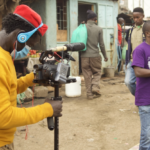
How a pioneering African film captured a community’s climate resilience
How a pioneering African film captured a community’s climate resilience
Welthungerhilfe: Early Warnings That Go Unheard
Welthungerhilfe: Early Warnings That Go Unheard
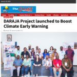
The Coast Media Group: DARAJA Project launched to Boost Climate Early Warning
The Coast Media Group: DARAJA Project launched to Boost Climate Early Warning
K24TV: DARAJA Launch Of A Weather Climate Campaign To Avert Climate Risks In Mombasa
K24TV: DARAJA Launch Of A Weather Climate Campaign To Avert Climate Risks In Mombasa
Dream Achievers Youth Organization (DAYO) Yazindua Mradi wa DARAJA
Dream Achievers Youth Organization (DAYO) Yazindua Mradi wa DARAJA

COP29 – Resurgence MP iLab Human Settlements: Early warnings and climate risk
COP29 – Resurgence MP iLab Human Settlements: Early warnings and climate risk

Meteorological Technology International September 2024 Issue: DARAJA All Inclusive (P.8-9)
Meteorological Technology International September 2024 Issue: DARAJA All Inclusive (P.8-9)

World Risk Poll 2024 Report: Resilience in a Changing World
World Risk Poll 2024 Report: Resilience in a Changing World
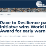
Race to Resilience partner initiative wins World Habitat Award for early warning tool
Race to Resilience partner initiative wins World Habitat Award for early warning tool

Community-Designed Weather Warning System Offers Hope for UN’s Global Initiative
Community-Designed Weather Warning System Offers Hope for UN’s Global Initiative
The Lloyd’s Register Foundation World Risk Poll Blog: Supporting urban community climate resilience in East Africa
The Lloyd’s Register Foundation World Risk Poll Blog: Supporting urban community climate resilience in East Africa

African Housing News: World Habitat Awards 2024 Recognize Housing Initiatives that Empower Communities
African Housing News: World Habitat Awards 2024 Recognize Housing Initiatives that Empower Communities

Urban Sustainability Exchange: World Habitat Awards 2024
Urban Sustainability Exchange: World Habitat Awards 2024
Specification Online: Housing initiatives combating climate injustice and empowering communities win 2024 World Habitat Awards
Specification Online: Housing initiatives combating climate injustice and empowering communities win 2024 World Habitat Awards

Elemental: 2024 World Habitat Award Winners
Elemental: 2024 World Habitat Award Winners
Arch Daily: World Habitat Awards 2024 Recognize Housing Initiatives that Empower Communities
Arch Daily: World Habitat Awards 2024 Recognize Housing Initiatives that Empower Communities

BIG ISSUE: DARAJA World Habitat Award 2024 Win
BIG ISSUE: DARAJA World Habitat Award 2024 Win

The Pioneering Housing Initiatives Combating Climate Injustice and Empowering Communities: 2024 World Habitat Awards Announced
The Pioneering Housing Initiatives Combating Climate Injustice and Empowering Communities: 2024 World Habitat Awards Announced
East African Watch: DARAJA World Habitat Award 2024 win
East African Watch: DARAJA World Habitat Award 2024 win

REAP interview with Mark Harvey, Resurgence
REAP interview with Mark Harvey, Resurgence
UNDRR WiA Podcast: multi-hazard early warning systems featuring DARAJA
UNDRR WiA Podcast: multi-hazard early warning systems featuring DARAJA
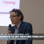
Hugh King, from the British High Commission in Uganda introduces the launch of DARAJA East Africa program
Hugh King, from the British High Commission in Uganda introduces the launch of DARAJA East Africa program

The Cooperator Uganda – Extreme weather: DARAJA East Africa Scale Up Programme to provide early warnings
The Cooperator Uganda – Extreme weather: DARAJA East Africa Scale Up Programme to provide early warnings

UBC Radio’s Diano Olweyni Peters reporting on DARAJA East Africa launch
UBC Radio’s Diano Olweyni Peters reporting on DARAJA East Africa launch
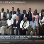
Smart24 TV – Bwaise Residents To Get Weather Forecasts
Smart24 TV – Bwaise Residents To Get Weather Forecasts

Daily Monitor Uganda – Urban poor to benefit from locally made weather system
Daily Monitor Uganda – Urban poor to benefit from locally made weather system

New Vision Uganda – Early warning climate system kicks off in Bwaise
New Vision Uganda – Early warning climate system kicks off in Bwaise
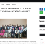
Elix News Uganda – DARAJA East Africa Programme to Scale up Urban Early Warning Initiative Launched
Elix News Uganda – DARAJA East Africa Programme to Scale up Urban Early Warning Initiative Launched

KFM Uganda – Weather-monitoring programme unveiled in Kampala
KFM Uganda – Weather-monitoring programme unveiled in Kampala

Smart24 TV Uganda – Resurgence Launches weather early warning initiative, with Bwaise as pilot study
Smart24 TV Uganda – Resurgence Launches weather early warning initiative, with Bwaise as pilot study
Race to Resilience – Resurgence unveils DARAJA: Africa’s boldest urban early warning initiative
Race to Resilience – Resurgence unveils DARAJA: Africa’s boldest urban early warning initiative
REAP – Resurgence announces launch of the DARAJA East Africa Scale Up Programme
REAP – Resurgence announces launch of the DARAJA East Africa Scale Up Programme

Africa News – Kenya: Residents on a mission to reduce flooding damage (DARAJA)
Africa News – Kenya: Residents on a mission to reduce flooding damage (DARAJA)

KETA 2022 Climate Champion award winner: James Kirika, Weather Mtaani leader & DARAJA partner
KETA 2022 Climate Champion award winner: James Kirika, Weather Mtaani leader & DARAJA partner

COP27 – COP CAS Student Blog from Walker Institute on DARAJA Early Action in Urban Communities
COP27 – COP CAS Student Blog from Walker Institute on DARAJA Early Action in Urban Communities
Relentless drought, fatal flooding: Kenyan’s find climate solutions under threat of extreme weather
Relentless drought, fatal flooding: Kenyan’s find climate solutions under threat of extreme weather
A Nairobi slum vulnerable to flooding is engineering its own climate solutions
A Nairobi slum vulnerable to flooding is engineering its own climate solutions

Climate Frontier Finance: Weather leaders in Nairobi win award for EWS under DARAJA
Climate Frontier Finance: Weather leaders in Nairobi win award for EWS under DARAJA
How a pioneering African film captured a community’s climate resilience
How a pioneering African film captured a community’s climate resilience
Meteorological Technology International’s Case Study of DARAJA
Meteorological Technology International’s Case Study of DARAJA
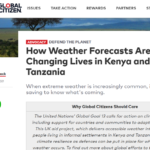
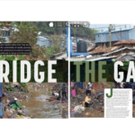
How Weather Forecasts Are Changing Lives in Kenya and Tanzania
How Weather Forecasts Are Changing Lives in Kenya and Tanzania

We need cash to adapt, Kenyan slum dwellers tell COP26 president
We need cash to adapt, Kenyan slum dwellers tell COP26 president

COP26 President and UK High Commissioner to Kenya visit Tomorrow’s Cities partner
COP26 President and UK High Commissioner to Kenya visit Tomorrow’s Cities partner

DARAJA – How a weather and climate service is bringing benefits to the most vulnerable communities in East Africa
DARAJA – How a weather and climate service is bringing benefits to the most vulnerable communities in East Africa
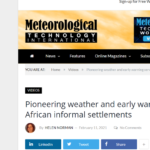
Pioneering weather and early warning services for African informal settlements
Pioneering weather and early warning services for African informal settlements
Feature on Kenyan slum project premiers
Feature on Kenyan slum project premiers
Kenya: Slum Weather Data Project Wins Praises
Kenya: Slum Weather Data Project Wins Praises

Weather warning and forecast service brings benefits to East African nations
Weather warning and forecast service brings benefits to East African nations

Resurgence recognised for collaborative weather communication project
Resurgence recognised for collaborative weather communication project
DARAJA: Development of locally accurate weather forecasts
DARAJA: Development of locally accurate weather forecasts
DARAJA outcomes : African leaders highlight weather service achievements
DARAJA outcomes : African leaders highlight weather service achievements
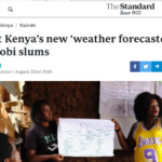
Meet Kenya’s new ‘weather forecasters’ in Nairobi slums
Meet Kenya’s new ‘weather forecasters’ in Nairobi slums

How Youth Activists Are Averting Weather Crises In Slums
How Youth Activists Are Averting Weather Crises In Slums
A case of mythbusting and opportunity: the weather and COVID-19
A case of mythbusting and opportunity: the weather and COVID-19

Improving weather and climate information in informal urban settlements
Improving weather and climate information in informal urban settlements

Creating a shared platform for forecasters, community, media and city governments
Creating a shared platform for forecasters, community, media and city governments
Helping national forecasters gain critical insights
Helping national forecasters gain critical insights

Forging a common understanding: Q & A with Vera Bukachi
Forging a common understanding: Q & A with Vera Bukachi
Planetary Security at the Hague: Promoting Systems Level Design Approaches to Weather and Climate Information Services
Planetary Security at the Hague: Promoting Systems Level Design Approaches to Weather and Climate Information Services

Defining and Looking Beyond Weather and Climate Information Services (WCIS) for residents of informal settlements
Defining and Looking Beyond Weather and Climate Information Services (WCIS) for residents of informal settlements
Thank you to our implementation partners for the photography. Any queries please contact dilupa@resurgence.io.
